Category:Thornhill, Ontario
Jump to navigation
Jump to search
neighbourhood in the Greater Toronto Area  | |||||
| Upload media | |||||
| Instance of | |||||
|---|---|---|---|---|---|
| Location | Regional Municipality of York, Ontario, Canada | ||||
 | |||||
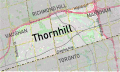
English: Thornhill is an unincorporated community that straddles the cities of Markham and Vaughan in Ontario, Canada. It is bounded by Steeles Avenue in the south, Highway 404 in the east, the Richmond Hill municipal border in the north (approximately Highway 7 from Highway 404 to Bayview Avenue, then Highway 407 westward), and Duffering Street in the west.
Subcategories
This category has the following 7 subcategories, out of 7 total.
B
G
- German Mills Settlers Park (4 F)
O
- Office Depot (Thornhill) (2 F)
P
S
- SmartCentres Thornhill (5 F)
T
- Thornhill Village Library (10 F)
Media in category "Thornhill, Ontario"
The following 55 files are in this category, out of 55 total.
-
 15 Colborne Street.jpg 3,968 × 2,976; 7.53 MB
-
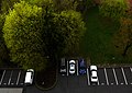 Cars are longer from above (34435552136).jpg 2,400 × 1,709; 1.69 MB
-
 Cham Shan Temple - A Chinese Temple in Toronto - Canada - 2014.JPG 5,472 × 3,648; 8.08 MB
-
 Class school photo 1976.jpg 960 × 620; 181 KB
-
 Conley Park.jpg 640 × 426; 318 KB
-
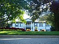 Event house Thronhill - panoramio.jpg 1,024 × 768; 310 KB
-
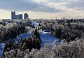
 Freezing rain in Thornhill (11497960953).jpg 4,272 × 2,848; 3.33 MB
-
 German Mills Nursery School sign.JPG 3,648 × 2,736; 3.15 MB
-
 Ghost rainbow in Thornhill (22238374844).jpg 2,257 × 1,535; 863 KB
-
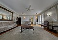 Heintzman House master bedroom.jpg 7,792 × 5,326; 5.79 MB
-
 Heintzman House.jpg 3,968 × 2,976; 4.45 MB
-
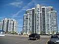 High buildings - panoramio.jpg 1,024 × 768; 203 KB
-
 Ice storm in thornhill (11526395693).jpg 2,000 × 1,420; 915 KB
-
 Ice storm in Thornhill (11559213166).jpg 2,012 × 1,400; 1.19 MB
-
 Leo Baeck North Campus.png 500 × 345; 350 KB
-
 MasonCogswells.jpg 3,264 × 2,448; 4.01 MB
-
 Moon is back (36712051452).jpg 2,400 × 1,600; 544 KB
-
 Oakbank Pond - panoramio.jpg 1,024 × 768; 114 KB
-
 OldVictoriaHall.jpg 3,264 × 2,448; 3.46 MB
-
 Peanut invasion (30521715971).jpg 2,534 × 1,718; 1.06 MB
-
 Planes coming to Pearson Intl. over Thornhill - panoramio.jpg 1,298 × 963; 236 KB
-
 Robert Shuter's house - panoramio.jpg 1,024 × 768; 214 KB
-
 September Morning (29612755570).jpg 2,000 × 1,340; 533 KB
-
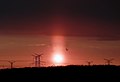 Solar fire (28734963048).jpg 3,508 × 2,398; 1.23 MB
-
 SpeedFeedbackRoadSign.jpg 4,928 × 3,264; 7.3 MB
-
 St. Luke's Roman Catholic Church and Manse.jpg 3,968 × 2,976; 3.84 MB
-
 St. Robert Catholic High School.jpg 2,048 × 1,536; 2.55 MB
-
 Storm is coming (20261644972).jpg 4,272 × 2,848; 2.46 MB
-
 Stormhill (20081939260).jpg 4,272 × 2,848; 1.93 MB
-
 Sunset in Thornhill (35881745460).jpg 2,400 × 1,600; 478 KB
-

-
 Thornhill (11578126393).jpg 2,136 × 1,424; 1.51 MB
-
 Thornhill (12709046955).jpg 2,136 × 1,424; 1.05 MB
-
 Thornhill (14619410190).jpg 2,000 × 1,356; 514 KB
-
 Thornhill (22861151145).jpg 2,136 × 1,424; 992 KB
-
 Thornhill (30564029041).jpg 2,136 × 1,424; 813 KB
-
 Thornhill Locator Map.svg 1,017 × 604; 19.07 MB
-
 Thornhill ontario gaarden.JPG 4,272 × 2,848; 3.91 MB
-
 Thornhill Ontario Sign Cropped.jpg 1,292 × 730; 802 KB
-
 Thornhill Ontario Sign.jpg 3,264 × 2,448; 4.26 MB
-
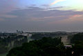
 Thornhill Panorama 2023.jpg 6,745 × 2,000; 10.74 MB
-
 Thornhill Weather (36267268612).jpg 4,000 × 3,000; 1.84 MB
-
 ThornhillInVaughan&Markham.jpg 872 × 452; 223 KB
-
 Unusual sunset in Thornhill (42724268471).jpg 4,000 × 3,000; 1.83 MB
-
 Vaughan Fire and Rescue services station 78.jpg 4,288 × 3,216; 7.6 MB
-
 Vaughan Fire at a house fire in April 2013.png 594 × 447; 678 KB
-
 Venus and Jupiter (18970347313).jpg 2,136 × 1,424; 764 KB
-
 Wilderman Medical Clinic.jpeg 300 × 199; 21 KB
-
 William Lane House.jpg 3,968 × 2,976; 5.37 MB
-
 Yonge at Steeles (looking Northwest) - panoramio.jpg 3,072 × 2,304; 2.2 MB
-
 Yonge St., Thornhill - panoramio.jpg 1,152 × 864; 168 KB
-
 Yonge Street at Colborne Street Sign - panoramio.jpg 3,072 × 2,304; 2.49 MB
-
 York Regional (16609018503).jpg 1,280 × 720; 82 KB
-
 York Regional Police K9 unit.png 848 × 365; 717 KB
-
 YRT Bus Stop ^1196 at St. Robert CHS - panoramio.jpg 3,072 × 2,304; 2.6 MB

.jpg)


.jpg)

.jpg)


.jpg)
.jpg)


.jpg)


.jpg)


.jpg)
.jpg)


.jpg)
.jpg)
.jpg)

.jpg)
.jpg)
.jpg)
.jpg)
.jpg)


.jpg)

.jpg)


.jpg)


_-_panoramio.jpg)


.jpg)

